Finchley Garden Village conservation area
Skip to:
Location
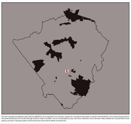
Finchley Garden Village is located to the south west of Church End, Finchley, close to the centre of the borough. It lies to the west of Hendon Lane and to the east of the Dollis Brook and Windsor Open Space.
The garden village is centred on Village Road, which feeds into Hendon Avenue to the north and Cyprus Avenue to south. These roads lead to the main thoroughfare of the A504, Hendon Lane. There is no vehicular access from the west, although two footpaths link Village Road with Windsor Open Space, the Brookside Walk and Holders Hill Road beyond.
The conservation area is tightly drawn and its boundary follows the rear garden boundaries on each side of Village Road.
The Finchley Garden Village Conservation Area is entirely residential in character, comprising a total of 51 properties and covers approximately 9 acres (3.6 hectares). It also lies within the Finchley Church End Ward, Barnet’s smallest ward with 15,571 residents.
Contains Ordnance Survey data © Crown copyright and database right 2023
Description
At the time of the Domesday Book (1086), the first complete survey of the country, Finchley was part of the Bishop of London’s lands.
Finchley Common stretched from the edge of the Bishop’s Park northwards to the county boundary. The land was made up of clay soil, which was considered unsuitable for cultivation and was therefore given over to woodland. The trees were gradually cut down and by the end of the 13th century settlements had been established on the edge of the common. In about 1350 the Bishop of London permitted travellers to pass through his park via a gate at the top of the hill, which became known as the Highgate.
Hendon Lane is one of the oldest roads in the area, known in 1659 as Finchley Hill and ran from Hendon to Church End, Finchley. The common had by this time been converted to pasture and small dairies began to be established.
The local population was made up of agricultural workers. Hay was the most important crop, meeting the demands of the growing number of horses in London. It was in 1690 that first mention is made of the Great North Road and its development contributed to the growth of inns, blacksmiths and similar establishments.
It was not until the coming of the railways that housing began to be developed more intensively in the area. The roads on the nearby Elm Park estate, off Nether Street, were laid out in the 1880s but were far from complete by 1912.
The 1895 Ordnance Survey map shows that although new housing existed on the roads to the east of Hendon Lane, little development had taken place on the western side and the land was largely laid out as fields in the ownership of Grass Farm.
It was not until 1909 that the land on which Village Road now sits was first developed
Documents
Finchley Garden Village conservation area Character Appraisal
Finchley Garden Village conservation area Design Guidance
Finchley Garden Village conservation area map

