Wood Street conservation area
Skip to:
Location
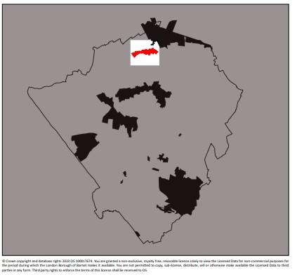
The Wood Street Conservation Area runs east to west from the junction with the Great North Road at the top of Barnet Hill (marked by St John the Baptist Church) along the ridge towards Arkley.
The Conservation Area was designated in 1969, and subsequently extended in 1979.
It includes the historic shops coming up Barnet Hill and surrounding St. John’s Church, Union Street to the north, the villas facing Ravenscroft Park, and Wood Street itself westward as far as The Whalebones, with its lands and the detached houses opposite.
The historic county boundaries are a notable aspect of this part of the Borough with Wood Street forming a peninsula of Hertfordshire cutting eastward into Middlesex.
Contains Ordnance Survey data © Crown copyright and database right 2023
Description
The High Street around St John’s Church is part of the commercial town centre of Chipping Barnet, with a variety of town centre uses, of which shopping is the most dominant.
The main retail character is that of small independents, although a few nationals commonly functioning in minor town centres such as Greggs Bakers, Clarks Shoes, Boots, Robert Dyas, WH Smith, a range of banks, building societies and Opticians also have a presence.
Other uses such as restaurants, cafes, bars and public houses all make a significant contribution to the vitality and viability of the area along with churches, Barnet College, banks and driving schools.
Of particular note are the public open spaces within the Conservation Area, namely Ravenscroft Park and the Courthouse Recreation Gardens at the extreme eastern end. They function as local parks and are formally laid out and well maintained. They are predominantly used by school children and college students and other people living or working in the area. The parks are busiest in the summer around midday, when office workers join local residents to enjoy the sunshine.
Documents
Wood Street conservation area Character Appraisal
Wood Street conservation area map

