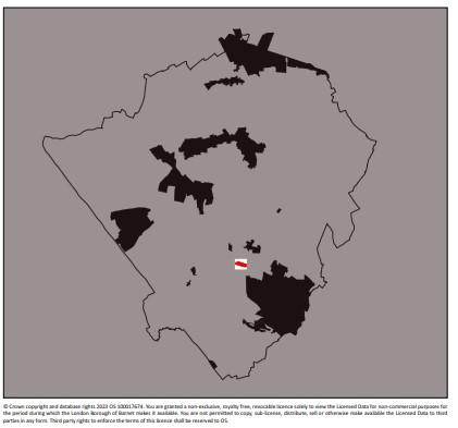
College Farm conservation area
Skip to:
Location
College Farm is located on the western side of Regents Park Road, to the south of Church End, Finchley.
It sits between Fitzalan Road and Allandale Avenue, which define the conservation area’s northern and southern boundaries respectively. These roads provide a direct link between Regents Park Road and Hendon Lane.
There is an unused vehicular access onto Regents Park Road, with a long track running westwards through the centre of the site to the farm buildings at the top of the hill. The main vehicular and pedestrian access point is located along Fitzalan Road.
The conservation area is tightly drawn and its boundary follows that of the College Farm site.
The College Farm Conservation Area is entirely rural in character, comprising a large complex with outbuildings and covers approximately 1.5 acres (3.8 hectares)
Contains Ordnance Survey data © Crown copyright and database right 2023
Description
At the time of the Domesday book (1086), the first complete survey of the country, Finchley was part of the Bishop of London’s lands. Finchley Common stretched from the edge of the Bishops’s Park northwards to the county boundary.
The land was made up of clay soil, which was considered unsuitable for cultivation and was therefore given over to woodland. The trees were gradually cut down and by the end of the 13th century settlements had been established on the edge of the common.
In about 1350 the Bishop of London permitted travellers to pass through his park via a gate at the top of the hill, which became known as the Highgate.
The land upon which College Farm now sits, had been farmland for centuries, but was used for grazing sheep and not cattle.
It is first mentioned as Sheephouse Farm, in a legal document of the time of Edward II, when it was in the tenancy of Henry de Bedyk, who held the lordship of the manor of Bibsworth, Finchley, from 1302 to 1335. His official title was ‘Taxor and Collector of the Customs of the Staple of Wools for the Shire of Middlesex’. He is recorded as having sold the Finchley farm, Sheep House ‘and a mill, with 146 acres of land, 7 acres of meadow and 5 acres of wood’.
The little brook which meanders along at the foot of the southern sloping fields is still called Mutton Brook, a name long ascribed to the fact that from medieval times sheep were dipped in it
Documents
College Farm conservation area map

